| Types: | Adventure, Scientific |
|---|---|
| Challenges: | Fully human powered, GPS, No food drops, No preplaced food caches, No resupplies, Off-track, Solo, Use of tracks |
| Countries: | Australia |
| Regions: | Oceania |
| Landscapes: | Forest, Grassland, Lake, Mountain, River |
| Route type: | A-B-C |
| Altitudes: | from 0m to 1617m |
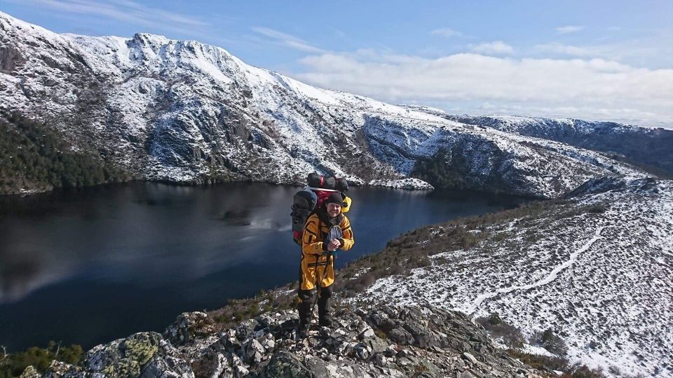
The longest unressupplied expedition in Tasmania (To be confirmed) at 52 days.
World First unressupplied crossing of Tasmania in the winter.
The longest distance covered ?
The heaviest backpack from start to end (62kgs = 30 kgs of food, 30kgs of equipment and gas, 2 liters of water) - end with +-26kg of equipment, trash. About 2,5kgs of equipment was left underway for later collection and 1,5kgs lost in the Derwent river.
John McLaine, his family and friends and many more to credit.
The reason why it is partial success is he wanted to reach the South Cape part of his aims. On his intended planned route he also wanted to paddle down the Gordon River Gorge, which is already dangerous in the summer but it is regarded as a Class IV or V river in the winter. Alone on such dangerous place is not advised. After his accident on the Derwent river (mid-expedition) he decided to take a less dangerous (river-wise) route. This route change did pass close to Mount Anne so he couldn't go for this summit during winter.
On his very last day, food ran completely out 2 hours before the end. ABC television was waiting. Mentally and physically exhausted, attempting to go back bushbashing offtrack to the South Cape and back (2 * 5km) would have take an extra day that would have been too much. He reached Cox Bight (bay, Southern Ocean) on the South Coast Track on the 20th of September 2018 so linking the North and South coast of Tasmania just before the end of the winter (21 September)
The expedition is still a success by being the first unresupplied crossing / traverse of Tasmania in the winter with the set rules:
- no resupply in food or gas
- only sleeping in the tent (so 51 nights)
- no use of asphalt roads*
* There are a few exceptions to this rule:
- crossing the Gordon River road (B61) between Lake Gordon and Lake Pedder. This was 600+200m of dirt track following the end of the canal; and 200 m of asphalt on the B61. This is where LouPhi got stopped for a chat by a police officer.
- Joining the end of the PCT (Penguin Cradle Trail) that ends with the Speeler Trail to join the Cradle Mountain Interpretation Centre's parking, there is 550m of macadam and sidewalks.
- The start of the expedition is 3,4km of road (mainly the Ironcliffe road) to the start of the PCT
- The PCT is for a small part (11,3 km) on actual residential roads, passing in villages and farms. This starts with the end of the Purtons Flat Track to reach the Winduss road. The PCT follows the Windus Rd, S Riana Rd and the the long Lowana Rd that is following the Leven river on its Western side.
| Name | Roles | |
|---|---|---|
|
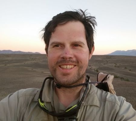
Louis-Philippe Loncke | Expedition leader |